
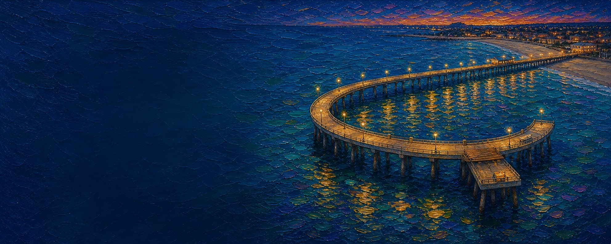
Redondo Beach Municipal Pier (Horseshoe Pier)
Redondo Beach, California
Fishing conditions
Loading…
National Weather Service (api.weather.gov)
Loading…
NOAA CO-OPS predictions, station 9410738
- Sunrise—
- Sunset—
Dawn/dusk and a moving tide (the hour around a high or low) typically bring the most active bite — worth timing a trip around whichever falls closest to first/last light.
Loading…
Loading buoy telemetry…
NOAA National Data Buoy Center
The modern seventh-generation Municipal Pier is a 25-foot-high, horseshoe-shaped concrete-piling structure with about 70,000 square feet of open space. The 1928 timber Horseshoe Pier was badly damaged by storms and a May 1988 electrical fire; the 1995 reconstruction approximated its historic alignment and added a new connection to the surviving Monstad Pier (built 1926). Most of the deck is concrete, while the Monstad section keeps rough wooden planks. The eastern/inner side is lined with a changing mix of seafood markets, restaurants, bait/tackle, and shops, including Quality Seafood and Pacific Fish Center in the current directory.
Species & regulations
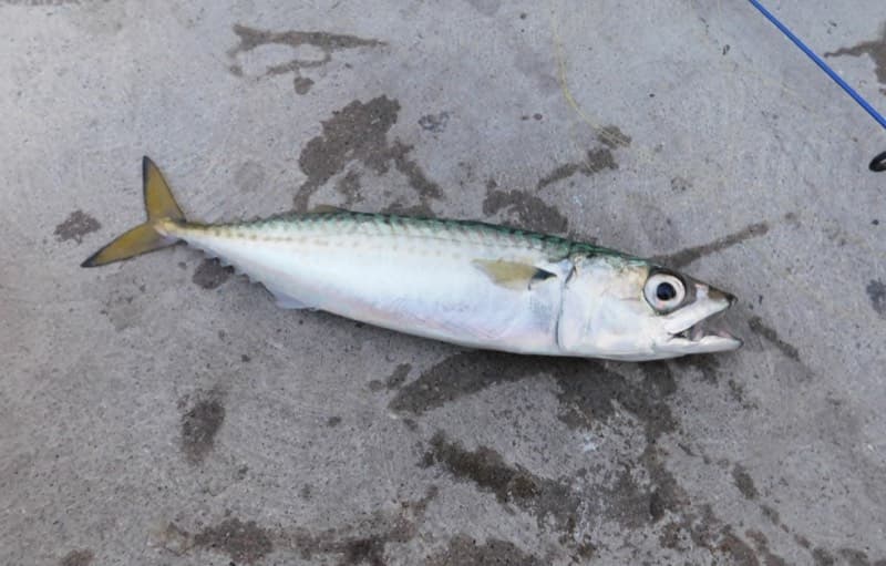
Sabiki or similar multi-hook rig; small strips of squid or mackerel. The pier report identifies mackerel as the dominant catch and recommends the Monstad section, southwest corner, or end rail, especially early evening and at night.
⚠ OEHHA Santa Monica Pier-to-Seal Beach Pier advisory: women 18-49 and children 1-17 should limit Pacific chub mackerel to 4 servings per week; women 50+ and men 18+ to 4 servings per week (eat only skinless fillet).
Photo: Ruff tuff cream puff · CC0 (public domain dedication)
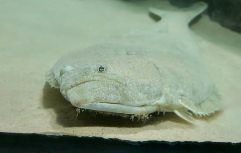
Live smelt, shinerperch, sardine, or baby mackerel on a Carolina/slider-style bottom rig; the Monstad mid-depth rail is the local report's best-known area.
⚠ OEHHA advisory: 1 serving per week for women 18-49 and children 1-17; 2 servings per week for women 50+ and men 18+.
Photo: RatioTile · CC BY-SA 4.0
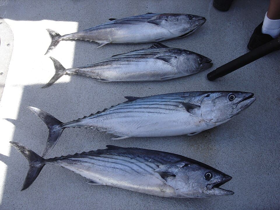
Small metal jigs, live bait, or strips of mackerel when pelagics push through the outer rail; warm-water years improve the odds, according to the local pier report.
Photo: nmoorhatch via Andrawaag · CC BY 4.0
Small hooks baited with bloodworm, mussel, or sand crab near the inner pocket and piling line; keep casts close to structure rather than the deepest outer water.
⚠ OEHHA lists surfperch in this advisory zone: 2 servings per week for women 18-49 and children 1-17, and 2 servings per week for women 50+ and men 18+.
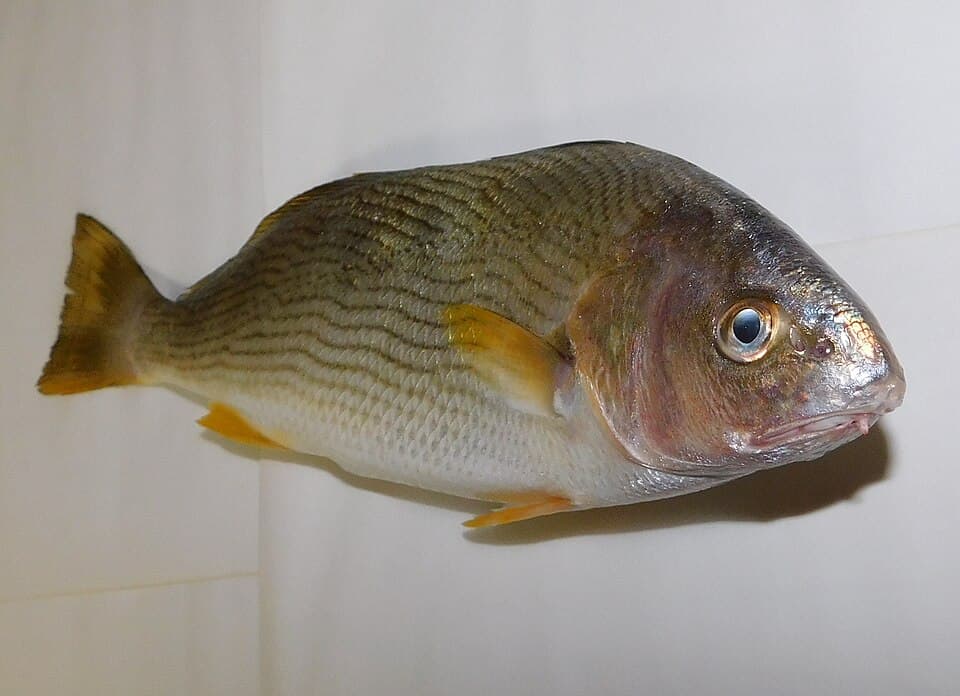
Bloodworms/lugworms, fresh mussel, ghost shrimp, market shrimp, or cut anchovy on a small high/low rig in the inner pocket and shallow walkway water.
⚠ OEHHA advisory: 2 servings per week for women 18-49 and children 1-17, and 2 servings per week for women 50+ and men 18+.
Photo: Ruff tuff cream puff · CC0 (public domain dedication)
Small bait on a bottom rig will often find them in inner or mid-depth water, but release rather than keep them because of the site-specific advisory.
⚠ OEHHA says do not eat white croaker from Santa Monica Beach south of Santa Monica Pier to Seal Beach Pier; Redondo Beach Pier lies within that boundary.
Bag/size limits sourced from CDFW's ocean sport fishing regulations — always double-check the current CDFW regs before keeping fish, as rules change.
Moon tracker
Recommended spots
- Monstad section — halibut rail
 Mid-depth inner rail
A regular angler cited by Pier Fishing in California identifies the area across from the bathrooms and seafood restaurant as the first-choice spot; the report calls this Monstad section a historic halibut area with lights and mid-depth water. Fish live smelt, shinerperch, sardine, or baby mackerel near bottom when legally obtained.
- Southwest outer cornerPelagic corner
The local report calls the southwest corner the hot spot for mackerel. Cast a Sabiki or small strip of squid through the water column, especially early, late, or at night when pelagic schools are present.
- Outer horseshoe arc

 Open-water outer rail
The ocean-facing arc has clean casting room and access to deeper water outside the loop. The local report lists mackerel, bonito, barracuda, sharks, rays, and occasional deep-water fish from outer/end areas, while noting pelagic action is cyclical.
- Inner horseshoe pocketSheltered inner water
The quieter water between the north and south walkways is under-fished relative to the outer rail. The local report records yellowfin croaker and some halibut here on bottom rigs with anchovy, bloodworm, mussel, or shrimp-sized bait.
- North walkway inner surf pocketShallow inner pocket
The local report identifies the surf area between Kincaid's and the north walkway as a distinct shallower option for croakers and occasional halibut. It is also the most wave-churned and pedestrian-constrained section, so the rating is deliberately modest.
Landmarks
- North pier gateway / Torrance Boulevard access
 access
Primary northern approach; coordinate generalized from the OSM footprint and current aerial imagery.
- Redondo Landing
 structure
Gateway building whose facade recalls the 1920s Looff Hippodrome and provides a history/interpretive entry point.
- Monstad Pier fishing sectionstructure
Connected 1926 timber-pier remnant with wooden planks, lights, a fishing platform, and the report's strongest halibut reputation.
- Seafood market and restaurant row
 amenity
Approximate inner/eastern concourse location. Current directory lists Quality Seafood, Pacific Fish Center & Restaurant, Pier Seafood, and other vendors; confirm tenants on site.
- Monstad fish-cleaning station and bait-cutting railsamenity
Local report describes bait-cutting platforms along the railing and a larger fish-cleaning sink in the Monstad section.
- King Harbor rubble breakwater (adjacent hazard)
 hazard
Rock breakwater and harbor entrance north of the pier; it is not part of this pier and can increase winter wave/current exposure.
Vegetation / growth assessment
Current Esri World Imagery shows the horseshoe over mostly open water and an inner sandy pocket; no distinct floating kelp canopy can be confirmed at pier scale from the reviewed crop. Kelpwatch provides 1984-present Landsat and 2017-2024 California Planet canopy layers, but the interactive AOI query was unavailable, so this is not a claim of zero kelp. A 2016 regional status report documents intermittent kelp along King Harbor breakwaters since at least 2005, meaning nearby rock can support kelp even though the pier footprint reads as open/sandy. Expect low, localized piling fouling or drifting algae rather than a mapped kelp forest.
Piers grow algae, mussels, and barnacles on their pilings and along the deck edges over time — that build-up is what this section tracks. The more growth in a stretch, the easier it is for your hook, sinker, or line to catch on it and get stuck, which is one of the most common ways beginners lose tackle. Heavier growth isn't a reason to avoid a spot — it often holds bait and structure fish like — just expect to snag more and re-tie more often there.
The most growth on Redondo Beach Municipal Pier (Horseshoe Pier) is on the right flank near the base — expect occasional snags there; nothing else on the structure reads heavier.
- Left flank · noneunconfirmed, not yet assessed
No side-specific vegetation observation was independently verified here; gridded as checked, none confirmed.
- Right flank · noneunconfirmed, not yet assessed
No side-specific vegetation observation was independently verified here; gridded as checked, none confirmed.
- Left flank · lightsome growth, light snag risk
Inner loop borders the sandy pocket visible in current aerial imagery; no canopy patch is distinguishable at this resolution.
- Right flank · lightsome growth, light snag risk
Ocean-facing flank reads as open water without a persistent surface canopy in the reviewed crop; dark tone alone is not treated as vegetation.
- Right flank · moderatemoderate growth, expect occasional snags
Cautious adjacent-area flag only: the King Harbor breakwater north of the pier has documented intermittent kelp. This does not establish kelp on the pier flank.
- Left flank · lightsome growth, light snag risk
Piling and restaurant/market structures can collect local biofouling, but no multi-date water-color evidence justified a stronger rating.
- Outer end · lightsome growth, light snag risk
No direct canopy check off the loop end; retained as a cautious baseline rather than an assertion of absence.
Reference sources
- OpenStreetMap — Redondo Beach Pier relation 9363404
- Esri World Imagery export used for current aerial check
- Redondo Pier — About and history
- Redondo Pier — current business directory
- City of Redondo Beach Waterfront Historic Resources Evaluation (2015)
- Pier Fishing in California — Redondo Beach Pier (updated 2023-07-30)
- NOAA Tides & Currents — King Harbor station 9410738
- NOAA tide predictions — station 9410738
- CDFW — California Beach Fishing / public piers
- CDFW — current Southern California ocean regulations
- CDFW — general ocean finfish regulations
- California Code of Regulations §28.32 — Pacific bonito
- CDFW — Aerial Kelp Surveys
- Kelpwatch.org — map
- Kelpwatch.org — methodology
- Status of the Kelp Beds in 2016 — King Harbor breakwater context
- OEHHA — Santa Monica Pier to Seal Beach Pier fish advisory
- Wikimedia Commons — Pacific mackerel photo
- Wikimedia Commons — California halibut photo credit page
- Wikimedia Commons — Pacific bonito photo
- Wikimedia Commons — yellowfin croaker photo