
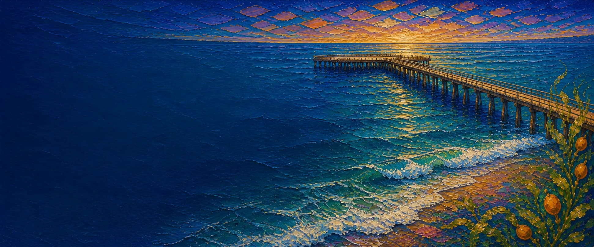
Seal Beach Pier (Seal Beach Municipal Pier)
Seal Beach, California
Fishing conditions
Loading…
National Weather Service (api.weather.gov)
Loading…
NOAA CO-OPS predictions, station 9410660
- Sunrise—
- Sunset—
Dawn/dusk and a moving tide (the hour around a high or low) typically bring the most active bite — worth timing a trip around whichever falls closest to first/last light.
Loading…
Loading buoy telemetry…
NOAA National Data Buoy Center
Second-longest wooden pier in California. Straight single-width wooden deck for ~85% of its length, widening into a T-shaped horseshoe platform at the outer end (former Ruby's Diner site, closed and fire-damaged in 2016 — the footprint is now open public deck).
Species & regulations
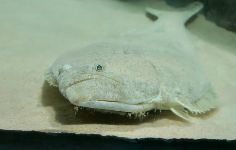
Live bait (anchovy, smelt, small mackerel) fished near bottom, drifted with the current — best from the T-end where depth is greatest.
Photo: RatioTile · CC BY-SA 4.0
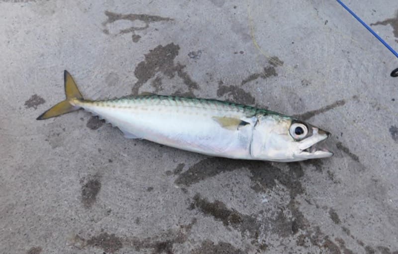
Sabiki/multi-hook rigs or small strips of squid; schools move through unpredictably, good bait source for halibut too.
Photo: Ruff tuff cream puff · CC0 (public domain dedication)
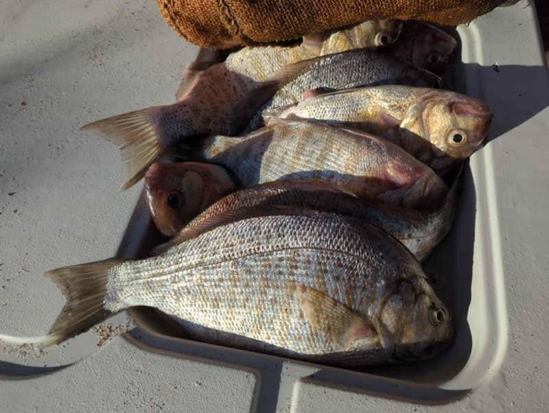
Sand crabs or bloodworms fished in the surf zone near the pier base.
Photo: N1ywb · CC BY-SA 3.0
Sand crabs, mussels, or bloodworms fished close to the pilings.
Photo: Matt Muir (iNaturalist) · CC BY 4.0
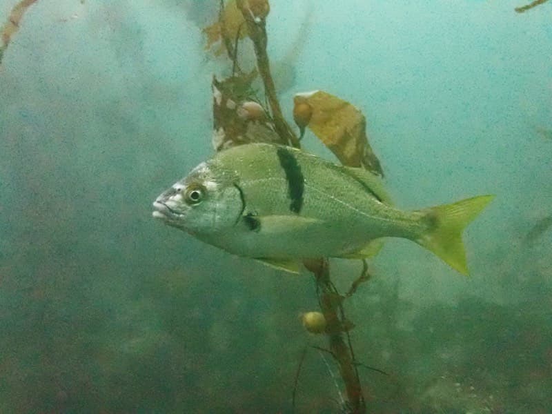
Similar rigs to surfperch — small hooks near structure/pilings.
Photo: Donald Davesne (iNaturalist) · CC BY 4.0
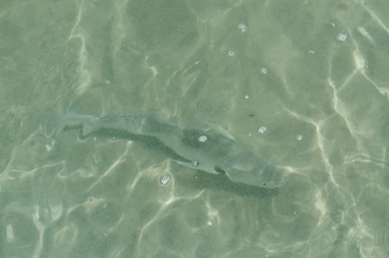
Sand crabs or clams on the bottom in the surf zone.
Photo: Donald Davesne (iNaturalist) · CC BY 4.0
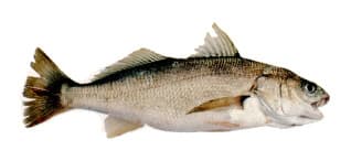
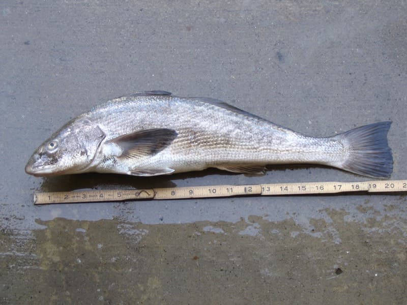
Very easy to catch on nearly any bait — but see the advisory below before keeping any.
⚠ OEHHA's Southern California DDT/PCB "do not consume" advisory zone for white croaker runs from Santa Monica Pier south to Seal Beach Pier — this pier is the advisory's southern boundary. Women 18–45 and children are advised not to eat white croaker caught here at all; catch-and-release is the safe default for everyone.
Photo: Milton Love, Marine Sportfish Identification (CDFG) · Public domain
Bag/size limits sourced from CDFW's ocean sport fishing regulations — always double-check the current CDFW regs before keeping fish, as rules change.
Moon tracker
Recommended spots
- T-End horseshoe rail
 Outer rail / deepest water
Widest, most open platform on the pier — casting room in nearly every direction. Deepest water on the structure, reachable without leaving the pier. Top-down imagery shows a uniform sandy/open seafloor here with no visible kelp canopy or dark vegetation patches, unlike rocky-reef piers elsewhere in SoCal.
- Mid-pier straight rail (~900–1300 ft mark)

 Open straight rail
Long unobstructed straight run of railing over open sandy bottom. Satellite imagery shows a consistent light, even seafloor tone here (no dark patches indicating algae/rock), and it sees less foot traffic than the entrance or the T-end.
- Piling-adjacent pockets (fish beside, not at, the pilings)Structure edge
Fish tend to hold near piling structure, but the pilings themselves carry mussel/algae biofouling that will foul lines and hooks. Cast just off the piling line rather than tight against it.
- Surf zone near pier base (first ~200 ft)Shallow surf zone
Consistently shows a turbid, wave-churned band in every satellite pass reviewed — shallow and lower-visibility water. Fine for corbina/surfperch but the most crowded, least open section given nearby playground and entrance foot traffic.
Landmarks
- Pier entrance — Main St & Ocean Ave
 access
Street-level access, adjacent metered parking.
- Eisenhower Park
 amenity
Beachfront park with ocean views next to the pier entrance.
- Pier Playground | Seal Beachamenity
Kids' playground and sandbox at the pier base.
- Seal Beach Showersamenity
Beachside rinse-off station.
- T-End Horseshoe Deck (former Ruby's Diner site)
 structure
Widened platform at the pier's outer end. Restaurant building closed in 2013 and fire-damaged in 2016; as of the latest available reporting the space remains an open deck with no confirmed tenant — verify current signage on site.
- Piling clusters (biofouling)
 hazard
Local fishing reports note mussel growth (biofouling) on the wooden pilings along the pier's length — not visible from orbital imagery at this resolution, but relevant when picking a cast line: fish adjacent to pilings, not directly into them, to avoid snagging on growth.
Vegetation / growth assessment
No rooted kelp canopy is visible anywhere along the pier — the seafloor is soft sand, which doesn't support the giant-kelp forests seen at rocky-substrate piers. But a darker fringe IS visible hugging one side of the deck, and it holds up as a real feature rather than a shadow: it appears in the same position, on the same side, across three independently-dated captures (2018-04-25 Wayback, 2026-08-05 Wayback, and current Esri/Google imagery) — a shadow would swing with sun angle between those dates and seasons; a fixed fouling/sediment band wouldn't, and doesn't here. It runs along the right-hand side of the pier as you walk from the beach out to the T-end (the up-drift/northwest-facing flank), is faint near the shallow surf zone at the base, and is most pronounced from roughly the 300 ft mark out through the T-end — consistent with the mussel/algae biofouling on the pilings noted in local fishing reports, and with sediment/organic buildup preferentially collecting on one side of a pier under longshore drift.
Piers grow algae, mussels, and barnacles on their pilings and along the deck edges over time — that build-up is what this section tracks. The more growth in a stretch, the easier it is for your hook, sinker, or line to catch on it and get stuck, which is one of the most common ways beginners lose tackle. Heavier growth isn't a reason to avoid a spot — it often holds bait and structure fish like — just expect to snag more and re-tie more often there.
The heaviest growth on Seal Beach Pier (Seal Beach Municipal Pier) is on the right flank near the tip — expect the most snags there, so budget a few extra rigs.
- Right flank · noneclear, low snag risk
No comparable fringe was independently confirmed in the shallow base interval; gridded as checked, none confirmed.
- Right flank · moderatemoderate growth, expect occasional snags
Darker fringe consistent across 2018 and 2026 imagery on the up-drift (northwest) side of the deck — read as sediment/algae buildup, not shadow.
- Right flank · heavyheavy growth, high snag risk — bring extra rigs
Band is widest and darkest near the T-end, where it lines up with the piling mussel growth local fishing reports describe.
- Left flank · lightsome growth, light snag risk
Shown for complete coverage, not because we found a matching feature: the same multi-date imagery review that found the right-flank fringe showed no comparable dark band on this (southeast-facing) side. Read as clear/baseline, not a confirmed hazard.
- Outer end · moderatemoderate growth, expect occasional snags
Past the T-end, gridded to the platform's approximate 90 ft width. Not independently confirmed by a direct water-color check off the end cap the way the flank was — set to moderate as a cautious estimate given its direct connection to the same piling cluster driving the heavy zone on the right flank, not a fully separate observation.
Reference sources
- PVS Fishing — Seal Beach pier report
- Red Dot Pier — Seal Beach Pier
- California Beaches — Seal Beach Municipal Pier
- Kelpwatch.org — statewide kelp canopy map (Landsat/Planet)
- CDFW Aerial Kelp Surveys
- CDFW — California Recreational Ocean Fishing Regulations
- CDFW — 2026 California Ocean Sport Fishing Regulations (PDF)
- CDFW Marine — public pier license exemption
- OEHHA — Southern California fish consumption advisory (PDF)
- NOAA Tides & Currents — Los Angeles station 9410660
- NWS forecast for Seal Beach, CA