
Trinidad Pier (Seascape Pier)
Trinidad, California
Fishing conditions
Loading…
National Weather Service (api.weather.gov)
Loading…
NOAA CO-OPS predictions, station 9419059
- Sunrise—
- Sunset—
Dawn/dusk and a moving tide (the hour around a high or low) typically bring the most active bite — worth timing a trip around whichever falls closest to first/last light.
Loading…
Loading buoy telemetry…
NOAA National Data Buoy Center
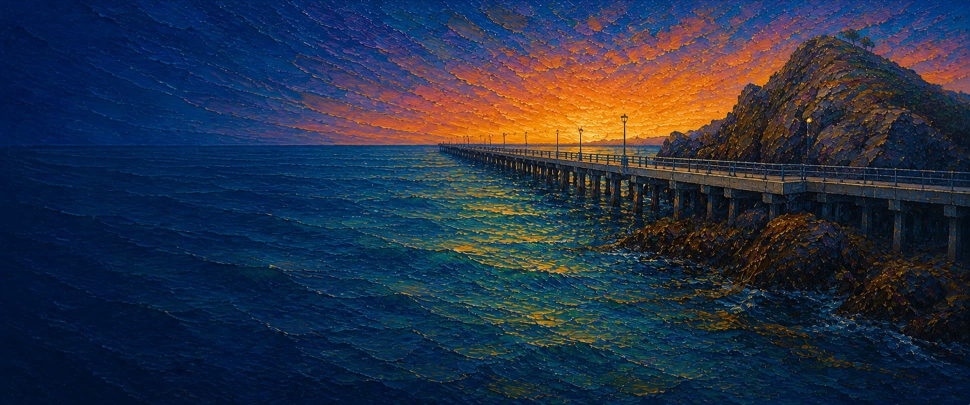
Working harbor pier at Trinidad Seascape Pier & Harbor. CEQA and harbor-history sources describe a roughly 540-ft pier on the same basic footprint as the 1946 structure; the rebuilt version replaced creosote-treated timber with steel piles and an impervious concrete deck that drains runoff to land-based treatment. Reporting on the 2012 rebuild also notes lights along both sides, four hoists and a weighmaster shed at the outer end, plus an ADA-standard aluminum gangway down to the floating dock used during salmon season.
Species & regulations
Best around the outer end or lower-dock water with a live perch under a float, a whole squid, or an active swimbait presentation near hard bottom.
Small hooks with fresh mussel, shrimp, tube worms, or crab backs fished tight to Little Head or the Pier Beach rocks.
Fish natural baits tight to the rocky east side or the outer hard-bottom end; bites often come right in crevices and ledges.
Swimbaits and other moving artificials from mid-pier to the end are specifically called out in the local report for better-grade rockfish.
Work legal live bait or natural bait on the sandier west-side water from mid-pier outward, where the report shifts from rocks to sandy bottom.
Fish sand crabs, worms, or mussel on lighter tackle over the west-side sandy stretches and pocket water beside the inshore rocks.
Bag/size limits sourced from CDFW's ocean sport fishing regulations — always double-check the current CDFW regs before keeping fish, as rules change.
Moon tracker
Recommended spots
- Little Head rocky east-side pocket
 Rock-and-kelp structure
Pier Fishing in California identifies the east side beside Little Head as the best fishing on the pier: shallow-to-mid-depth rocky structure, kelp, algae, and fish-holding channels all sit close to the rail, producing greenling, rockfish, lingcod, and cabezon when anglers keep baits tight to the rocks.
- Outer-end hard-bottom railDeepest water / hard bottom
When anglers can fish the end section, the local report says this is the best place for larger lingcod, cabezon, and rockfish because it reaches deeper water and hard bottom with algae, corals, kelp, and sea stars.
- West-side inshore rocks by Pier Beach

 Close-in rock pockets
The local report calls out two large rocks just off Pier Beach on the west side as a consistent kelp-greenling zone. It is productive structure, but snag risk is high and the fishable window is tighter than on the Little Head side.
- Gangway / floating-dock waterDock structure
The fishing report says the floating-dock area has more bottom growth and more fish than the scoured piling zone, with schools of shinerperch that can also draw larger predators. Access and fishability depend on harbor activity.
- West-side mid-to-outer sandy waterSandy bay bottom
Farther out on the west side, the report shifts from rocks to mostly sandy harbor bottom. That favors surfperch, herring in winter, flatfish, tomcod/white croaker, and occasional sharks or rays, but it is less structure-rich than the rocky east side.
Landmarks
- Bay Street / pier entrance
 access
Landward entrance at the coastal end of Bay Street into Trinidad Seascape Pier & Harbor.
- Seascape Restaurant
 amenity
Restaurant at the harbor site; the harbor operator lists Trinidad Seascape Pier & Harbor at 1 Bay Street.
- Trinidad Boat Launchaccess
Mapped launch area beside the pier. Official harbor materials note shared access for boats, trailers, kayakers, and pedestrians.
- Little Head
 hazard
Rocky knoll tight to the pier's east side; local fishing reports describe this as the main rocky/kelp structure zone and the most snag-prone water.
- ADA gangway and floating dock
 structure
The rebuilt pier added an ADA-standard aluminum gangway down to the floating dock, heavily used during salmon season.
- Outer-end hoists / commercial loading zonehazard
Commercial harbor operations share the outer pier; 2012 reporting notes four hoists and a weighmaster shed at the end, and the fishing report warns that angler access can be limited around loading activity and the lower dock.
Vegetation / growth assessment
Trinidad Pier sits beside the Trinidad Kelp Beds / Areas of Special Biological Significance, and both reconstruction materials and long-form fishing reports describe real kelp/algae habitat around the structure. The clearest recurring pattern is side-specific: the east side beside Little Head stays the most rock-and-kelp-oriented water, the inner west side has a smaller rocky pocket by Pier Beach, the mid-to-outer west side transitions to sand, and the outer end reaches harder bottom again. Exact current canopy density was not verified from recent aerial imagery here, so the zones reflect documented habitat character rather than a recent measured kelp map.
Piers grow algae, mussels, and barnacles on their pilings and along the deck edges over time — that build-up is what this section tracks. The more growth in a stretch, the easier it is for your hook, sinker, or line to catch on it and get stuck, which is one of the most common ways beginners lose tackle. Heavier growth isn't a reason to avoid a spot — it often holds bait and structure fish like — just expect to snag more and re-tie more often there.
The heaviest growth on Trinidad Pier (Seascape Pier) is on the right flank, mid-structure — expect the most snags there, so budget a few extra rigs.
- Right flank · heavyheavy growth, high snag risk — bring extra rigs
Right side when walking out from shore, corresponding to the east/Little Head side. Fishing reports describe rocks, kelp, algae, and fish-holding channels tight to this rail.
- Left flank · moderatemoderate growth, expect occasional snags
Inner west side near Pier Beach and the two close rocks called out in the local report; real structure is documented, but not at the same continuous density as Little Head.
- Left flank · lightsome growth, light snag risk
Local report describes the west side from mid-pier toward the end as mostly sandy bottom. Light here means habitat was checked and reads as lower-growth than the rocky side, not necessarily sterile.
- Right flank · lightsome growth, light snag risk
Pier Fishing in California says the piling area is unusually scoured by sand and not heavily encrusted with mussels or barnacles except for seasonal juvenile-fish use.
- Outer end · moderatemoderate growth, expect occasional snags
The local report describes hard bottom with algae, corals, kelp, and sea stars off the end. Width is an approximate map-display value, not a measured platform width.
Reference sources
- CDFW Groundfish Regulations Summary — shore-based angler season/depth exemption
- OpenStreetMap Nominatim — Trinidad Pier way 10255647
- Pier Fishing in California — Trinidad Pier aka Seascape Pier
- Trinidad Seascape Pier & Harbor
- Trinidad Seascape Pier & Harbor — Trinidad Pier Reconstruction Project
- CEQAnet — Trinidad Pier Reconstruction
- McKinleyville Press — New Trinidad Pier (July 15, 2012)
- North Coast Journal — Trinidad Rancheria harbor history and improvements
- NOAA CO-OPS MDAPI — station 9419059 Trinidad Harbor
- NOAA CO-OPS MDAPI — tide prediction offsets for station 9419059
- CeNCOOS ERDDAP metadata — Trinidad Pier station TDPC1 / station 48097
- CDFW — Current California Ocean Recreational Fishing Regulations, Northern Region
- CDFW — Summary of Recreational Groundfish Fishing Regulations
- CDFW — California Recreational Ocean Fishing Regulations
- OEHHA — California Coastal Locations without Site-Specific Advice