
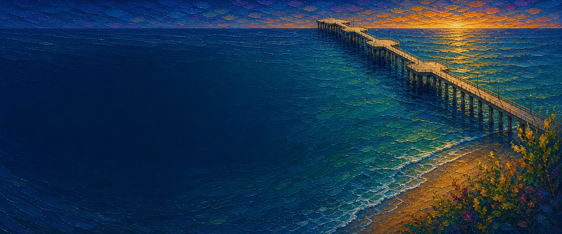
Huntington Beach Pier
Huntington Beach, California

Fishing conditions
Loading…
National Weather Service (api.weather.gov)
Loading…
NOAA CO-OPS predictions, station 9410580
- Sunrise—
- Sunset—
Dawn/dusk and a moving tide (the hour around a high or low) typically bring the most active bite — worth timing a trip around whichever falls closest to first/last light.
Loading…
Loading buoy telemetry…
NOAA National Data Buoy Center
Reinforced-concrete deck, approximately 30 feet wide and 38 feet above mean low water. The straight shaft widens through three octagonal platforms and ends in a diamond-shaped outer platform; the City history describes precast deck sections, epoxy-coated reinforcing steel, 131-foot concrete piles, and a 1,856-foot rebuilt pier.
Species & regulations
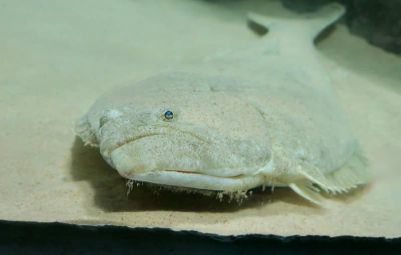
Present a live anchovy, smelt, perch, sardine, or mackerel close to the bottom in mid-pier piling depressions.
⚠ OEHHA's south-of-Seal-Beach guidance places California halibut in a group limited to one serving per week for women 18–45 and children 1–17, and two total group servings per week for women over 45 and men; check the current advisory before eating.
Photo: RatioTile · CC BY-SA 4.0
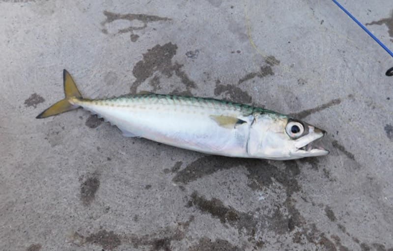
The end platform is the most reliable pelagic rail; use a Sabiki or small strip of squid/mackerel around bait schools and keep casts clear of diners.
⚠ OEHHA groups chub mackerel south of Seal Beach at no more than two total servings per week for women 18–45 and children 1–17, and four total servings per week for women over 45 and men; check species identification and current advice.
Photo: Ruff tuff cream puff · CC0
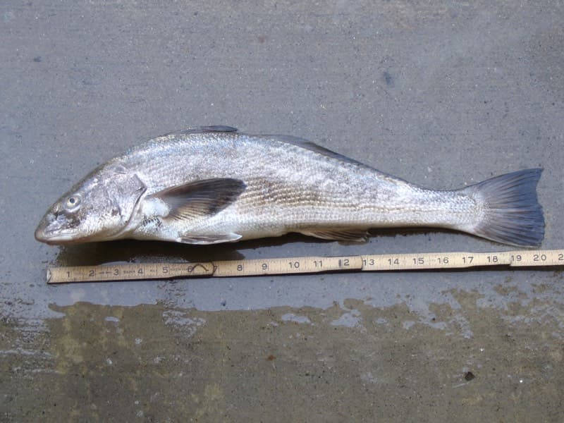
Work the inshore wash with sand crabs, bloodworms, or lugworms; light tackle and a natural presentation are important in the shallow sand.
⚠ OEHHA's south-of-Seal-Beach guidance allows no more than two total servings per week for women 18–45/children 1–17 and two total group servings per week for women over 45/men; check the current advisory before eating.
Photo: N1ywb · CC BY-SA 3.0
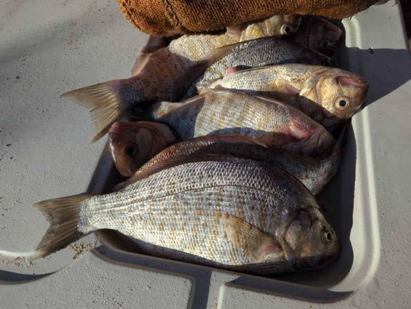
Fish the surfline and shallow structure with sand crabs, mussels, or bloodworms; barred surfperch are a primary inshore target in local reports.
⚠ OEHHA's south-of-Seal-Beach guidance places surfperches at no more than two total servings per week for women 18–45/children 1–17 and two total group servings per week for women over 45/men; check current advice.
Photo: Zack Abbey · CC BY 4.0
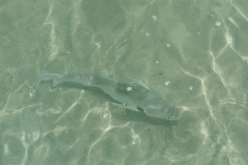
Try mussel, ghost shrimp, bloodworm, or market shrimp on the sandy inshore bottom and around the first piling clusters.
Photo: Donald Davesne · CC BY 4.0
A bottom bait such as squid, shrimp, mussel, or cut bait can produce white croaker; identify fish carefully before keeping them.
⚠ For coastal waters south of Seal Beach Pier, OEHHA guidance limits white croaker to one serving per week for women 18–45 and children 1–17, and two servings per week for women over 45 and men; this is not the separate do-not-consume zone north of Seal Beach Pier. Check current OEHHA guidance.
Bag/size limits sourced from CDFW's ocean sport fishing regulations — always double-check the current CDFW regs before keeping fish, as rules change.
Moon tracker
Recommended spots
- Mid-pier piling depressions
 Bottom / halibut ambush water
Pier Fishing in California calls the mid-pier area a favorite for halibut, especially the depressions between pilings. Present live anchovy, smelt, perch, sardine, or mackerel close to the bottom and avoid emergency-access zones.
- Inshore surfline

 Surfline / croaker and perch
Local pier-fishing reports describe the inshore sand as productive for barred surfperch, spotfin and yellowfin croaker, and corbina. Fish sand crabs, mussels, bloodworms, or lugworms along the wash, while watching for surfers and swimmers.
- Outer platform south railPelagic / open water
The pier's end is the consistent pelagic zone for Pacific and jack mackerel, sardines, and jacksmelt, with occasional bonito or barracuda. A 2022 local report specifically found the south side of the end strongest for mackerel and jacksmelt; use Sabiki or small strips and leave room around restaurant traffic.
- Outer platform northwest cornerShark and ray rail
The local guide reports larger sharks and rays toward the end, often around the northwest corner. This is a conditional opportunity: current crowding, restaurant operations, lighting, and posted closures can make the rail unfishable.
- Mid-to-end piling runStructure edge
The local report places the most useful piling water from mid-pier toward the end, but also notes that city cleaning has left many pilings relatively bare. Treat this as a structure opportunity rather than a guaranteed bite; fish just outside the piles to reduce snags.
Landmarks
- Pier entrance — Main Street and Pacific Coast Highway
 access
Shore access at the north end of Main Street, beside Pier Plaza and the beachfront promenade.
- Huntington's On The Pier project
 structure
Mapped pier building near 21 Main Street. The official project site says it is currently under construction with completion targeted for fall 2026; confirm construction fencing and access on site.
- Lifeguard building
 amenity
Lifeguard facility mapped along the pier shaft; follow posted safety directions and do not cast into emergency-access areas.
- Mid-pier restroom buildingamenity
Restroom footprint mapped near the middle of the pier; availability and hours should be checked on site.
- Broad Street Oyster Co. — end of the pierstructure
The restaurant's official listing gives 1 Main Street and daily 11 a.m.–8 p.m. hours; keep casts clear of the busy end-platform perimeter.
- Huntington Beach Pier Light (USCG 105)
 hazard
Private-aid special-purpose beacon mapped just beyond the outer platform; do not climb or attach gear to the light structure.
Vegetation / growth assessment
The checked Esri World Imagery export shows broad sandy surf and open water with no obvious floating kelp canopy (the intersecting citation footprint is dated 2025-11-07). OC San's 2021–22 marine report likewise says Huntington Flats and Huntington Flats-to-Newport Harbor showed no surface canopy in the regional aerial survey. Pier-fishing reports describe Huntington Flats as primarily sand and say many piles are now bare after cleaning. This does not rule out submerged algae, mussels, or localized pile fouling.
Piers grow algae, mussels, and barnacles on their pilings and along the deck edges over time — that build-up is what this section tracks. The more growth in a stretch, the easier it is for your hook, sinker, or line to catch on it and get stuck, which is one of the most common ways beginners lose tackle. Heavier growth isn't a reason to avoid a spot — it often holds bait and structure fish like — just expect to snag more and re-tie more often there.
Huntington Beach Pier's heaviest checked growth is still only light, on the left flank (its full length), the right flank (its full length), and the outer end — snag risk from vegetation is low across the structure right now.
- Left flank · lightsome growth, light snag risk
No persistent surface-canopy band verified along this flank in the dated imagery or regional aerial report; below-water pile fouling is unresolved.
- Right flank · lightsome growth, light snag risk
Open sandy water dominates the checked imagery; do not interpret this light baseline as proof that every submerged pile is clean.
- Outer end · lightsome growth, light snag risk
Outer diamond platform footprint; no surface canopy was visible or documented in the checked sources, while subsurface fouling was not resolvable.
Reference sources
- OpenStreetMap — Huntington Beach Pier way 45074900
- OpenStreetMap API — pier geometry and tags
- City of Huntington Beach — Rebirth of a Landmark: Huntington Beach Pier
- Huntington Beach General Plan / Coastal Element
- Broad Street Oyster Co. — Huntington Beach Pier
- Huntington's On The Pier — official project site
- Pier Fishing in California — Huntington Beach Pier
- Pier Fishing in California — May 2022 Southern California report
- CDFW — Surf Zone Fishes
- CDFW — Southern California ocean regulations
- CDFW — General ocean fishing regulations
- CDFW — Beach and public-pier fishing
- CDFW — Fish ID quiz (white croaker limit)
- OEHHA — Southern California coastal fish advisory
- NOAA CO-OPS — Newport Beach, Newport Bay Entrance station 9410580
- Kelpwatch methodology
- CDFW — Aerial kelp surveys
- Orange County Sanitation District — 2021–22 Marine Monitoring report
- Esri World Imagery service metadata
- Wikimedia Commons — California halibut photo
- Wikimedia Commons — Pacific mackerel photo
- Wikimedia Commons — California corbina photo
- Wikimedia Commons — barred surfperch photo
- Wikimedia Commons — spotfin croaker photo