
Ballona Creek / Playa del Rey South Jetty
Playa del Rey / Marina del Rey, California


Fishing conditions
Loading…
National Weather Service (api.weather.gov)
Loading…
NOAA CO-OPS predictions, station 9410660
- Sunrise—
- Sunset—
Dawn/dusk and a moving tide (the hour around a high or low) typically bring the most active bite — worth timing a trip around whichever falls closest to first/last light.
Loading…
Loading buoy telemetry…
NOAA National Data Buoy Center
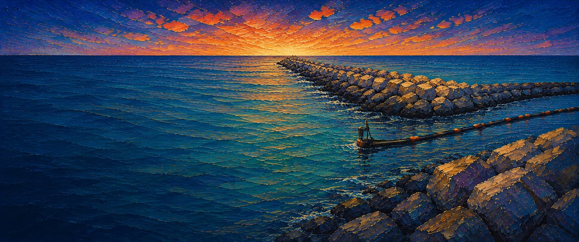
Shore-connected rubble-mound rock jetty on the south side of the Ballona Creek / Marina del Rey entrance. The walk begins at the Pacific Avenue pedestrian bridge and continues seaward along uneven armor rock; there is no elevated deck, railing, or T-end platform. The jetty lies in the lee of the Marina del Rey breakwater, but storm runoff, boat traffic, slippery rock, and changing surf make the outer end hazardous.
Species & regulations
Live anchovy, smelt or small swimbaits worked along the channel seam and outer head; retrieve above the rocks to reduce snags.
Small swimbaits, plastic grubs or cut bait along mussel-fouled riprap; fish the moving-water edge rather than the shallowest crest.
Small plastics or squid strips along the creek-mouth current seam and sandy pockets between rocks.
Sabiki or small metal jigs when schools show; the outer head and open-water side are the most plausible passing-school zones.
Bottom baits catch them readily around creek-mouth sediment, but release rather than keep them because of the Southern California DDT/PCB advisory.
⚠ OEHHA's Southern California advisory includes the Ballona Creek / Marina del Rey area: white croaker are among the fish for which consumption is discouraged, with stricter advice for women 18–45 and children. Check the current OEHHA map/advisory before eating any fish.
Bag/size limits sourced from CDFW's ocean sport fishing regulations — always double-check the current CDFW regs before keeping fish, as rules change.
Moon tracker
Recommended spots
- Seaward head
 Head / converging current seam
The outer head is the strongest meeting point of creek/entrance flow and ocean swell and is the highest-value structure for halibut, bass and mackerel. It is also the least forgiving rock and should be skipped in breaking swell or after heavy rain.
- Mid-jetty channel seam

 Current edge / riprap
The middle reach places hard rock beside the entrance-channel current and the creek plume. Local fishing references specifically identify kelp bass, sand bass and mackerel at the Ballona Creek jetty; cast along the seam and retrieve before the rock line.
- Outer ocean-facing flankWave-washed rock edge
The seaward flank has the cleanest open-water exposure and a stronger ocean/harbor mixing signal than the inner reach, but uneven footing and surge make it a conditional spot rather than a safety recommendation.
- Bridge-to-inner riprap edgeCreek-mouth structure
The first rock-to-channel transition is easiest to reach and keeps current, baitfish and estuarine outflow close, but it is also the most disturbed section near the bridge and channel traffic.
Landmarks
- Pacific Avenue / 62nd Street pedestrian bridge
 access
Foot and bicycle access across Ballona Creek; the south-jetty approach is on the Playa del Rey side.
- Pacific Avenue terminus parking
 amenity
County emergency-response documentation identifies the parking lot at the northern terminus of Pacific Avenue as the land-access point; verify fees, hours and closures.
- Ballona Creek mouth / channel seam
 structure
Transition between flood-control creek water, Marina del Rey entrance water and the open coast; current and boat wakes concentrate here.
- Ballona Creek trash-barrier area
 hazard
A permanent trash interceptor/barrier has operated on the creek jetty system; avoid fishing into booms, cables or floating debris.
- Outer seaward jetty headhazard
Most exposed rock and strongest ocean/entrance mixing; retreat is difficult if swell, tide or wind rises.
Rock + depth formation assessment
Los Angeles County says fishing at the Marina del Rey north and south jetties is licensed fishing. A California sport-fishing license is therefore required here unless a current posted CDFW public-pier designation says otherwise; all size, bag, season and gear rules still apply. Avoid fishing after storm runoff and follow current beach-health advisories.
The jetty is a rock access route rather than a decked pier. The inner section is creek/harbor sheltered, the middle section follows the entrance-channel seam, and the outer head is more ocean-exposed. I did not find a current public bathymetric grid or engineering toe survey tied to this exact rock line, so zones are categorical and no point depths are claimed.
A jetty's rock pile is the structure — there's no deck, just boulders stacked out into the water. Snags happen when your line or hook drops into a gap between rocks instead of open water. Rock sitting shallow, close to the surface, is the easiest to hang up on, and gets worse as the tide drops and exposes more of it. Rock that gives way to deeper water has less exposed structure to catch on, but a hook that does snag there is harder to pull free. Sandy gaps between rock sections are the clearest, lowest-snag water on a jetty.
Ballona Creek / Playa del Rey South Jetty's rock doesn't read as fully shallow anywhere assessed; the closest to it is the mixed-drop rock on the channel-facing flank, mid-structure and the ocean-facing flank, mid-structure — a moderate snag risk. 3 zones here haven't been depth-assessed yet — treat those as unknown, not clear.
- Channel-facing flank · unverifiednot yet assessed for snag risk
No reliable rock-toe depth classification was independently verified for this interval.
- Ocean-facing flank · unverifiednot yet assessed for snag risk
No reliable rock-toe depth classification was independently verified for this interval.
- Ocean-facing flank · unverifiednot yet assessed for snag risk
No reliable rock-toe depth classification was independently verified for this interval.
- Channel-facing flank · sandy pocketsandy gap, lowest snag risk
Creek/harbor-side inner reach; soft-bottom channel margin is more likely than a deep ocean-facing drop, but exact depth is unsourced.
- Channel-facing flank · mixed droprock into a slope, moderate snag riskVessel traffic · Current seam / converging flow
Entrance-channel flank beside hard rock; current and boat-channel geometry imply a sharper edge than the inner reach, without a numeric sounding.
- Ocean-facing flank · mixed droprock into a slope, moderate snag riskWave run-up
Ocean-facing flank is wave-washed and transitions from nearshore sand to the jetty toe; current depth is not confidently documented.
- Outer tip · deep waterdeep water at the rocks, less exposed but harder to free gear
The head is the strongest open-water/current transition on the structure, but this category is a qualitative fishing read, not a surveyed depth claim.

Reference sources
- Los Angeles County Beaches & Harbors — Marina del Rey fishing
- NOAA South Jetty, Marina del Rey site description
- NOAA Development of the Marine Communities report
- U.S. Army Corps of Engineers Marina del Rey structures history
- California Coastal Trail — Ballona Creek bridge and jetty
- CDFW — California beach fishing / public piers and jetties
- CDFW — California recreational ocean fishing regulations
- CDFW — 2026 California Ocean Sport Fishing Regulations PDF
- OEHHA — California fish advisories
- NOAA Tides & Currents — Los Angeles station 9410660
- Ballona Creek interceptor updates